
Koryukivska city territorial community
Administrative center: Koryukivka city
Community population: 20,112 people
Composition of the community: Koryukivka, Brech, Hurynivka, Lubenets, Nova Hurynivka, Ozeredy, Khovdiyivka, Buda, Mokhovyki, Petrova Sloboda, Sosnivka, Shishka, Domashlin, Beshkivka, Lukovets, Volovyky, Zabarivka, Kirillivka, Nova Buda, Andronyky, Vysoke, Naumivka, Peredil, Spichuvate , Turivka, Oleksandrivka, Verholissya, Pisky, Okhramievichi, Lupasove, Romanivska Buda, Prelyub, Balyas, Biloshitska Sloboda, Future, Prybyn, Kostyantynivka, Rudnya, Shishkivka, Bogdalivka, Hutyshche, Dovga Dam, Zalyadya, Oliiniki, Reimentarivka, Rybinsk, Zhuravleva Buda, Lisove, Novoselivka, Parastovske, Stopylka, the village of Golubivshchyna, Savinky, Burkivka, Budyshche, Samotugy, Syadryne, Telne, Kostyuchki, Kuguky, Samsonivka, Sahutivka, Tyutyunnytsia, Khotiivka.
The central estate is the Koryukivka City Council.
Address: 15300, Chernihiv region, Koryukivka, str. Boulevarna, 6
Work time: Mon-Fri 8:00-17:00 (Sat-Sun - weekend)
ZIP Code: 15300
E–mail адреса: koryukivka.rada@gmail.com
Official facebook: https://www.facebook.com/koryukivka.misto/
Contact phone number: (04657) 2-14-76
mayor Ratan Ratanovych Akhmedov
Map of the Koryukivka urban territorial community

The Koryukivka Territorial Community began to function on January 1, 2017.
In total, the Koryukivka community has 66 settlements - 1 city, 2 villages, 63 villages. OTG occupies an area of 117,390.4 square meters. km, which is 55.8% of the territory of the Koryukiv district. The population of the community is 20,950. The share of the urban population is 54.25%, the rural population is 45.75% of its total population. Population density – 22.98 people/sq. km
The administrative center of the community is the city of Koryukivka, located in the northern part of the Chernihiv region in the upper reaches of the Brech River (the left tributary of the Snov). The area of the city is 15 km². The population is 12,539 thousand people. Distance to the regional center: by railway - 237 km, by road - 99 km. Height above sea level — 133 m.
Koryukivka district on the map of Chernihiv region

Historical reference: Koryukivka was founded 364 years ago. During the reign of Hetman Bohdan Khmelnytskyi in 1657, looking for a land free from lordship, settlers from Right-Bank Ukraine led by the Cossack Omelyan Karuka chose for themselves a place reliably protected by forests and founded a small settlement - Koryukivka.
The city suffered heavy losses during the Second World War. Koryukivka was almost completely burned, the population that lived there was exterminated.
As a result of Hitler's crime, about 7,000 residents were killed (according to the act of 1944 – 6,700 people) and 1,290 houses were burned. The destruction of Koryukivka and its inhabitants by the Nazis is one of the greatest crimes committed by the Nazi occupiers in World War II in Europe. For comparison:
- Ukrainian Koryukivka - on March 1-2, 1943, about 7,000 people were killed and burned.
2. Belorussian Khatyn - on March 22, 1943, 149 people were killed in the village.
3. The Czech village of Liditsy - on June 11, 1943, 320 people were killed in the village and murdered in the concentration camp.
4. French Oradur - on June 10, 1944, 642 people were killed in the village.
Since 1966, Koryukivka has been the district center of the Koryukiv district of the Chernihiv region, and since 2020 it has been the center of the Koryukiv territorial community, which includes 15 territorial communities: Koryukivska, Bretska, Budyanska, Domashlinska, Zabarivska, Naumivska, Rybynska, Reimentarivska, Savynkivska, Syadrynska, Tyutyunnytska, Oleksandrivska, Okhramievytska, Perelyubska, Prybinska, Khotiivska with the administrative-territorial units (villages) belonging to these communities and the center of the expanded Koryukiv district, which includes Menska, Snovska, Sosnytska and Kholmynska territorial communities with their associated settlements.
Koryukivka is located at the intersection of regional and local highways, which are connected by bus to the regional center and neighboring cities: Snovsk, Mena, Semenivka and populated areas of the district. Five public roads of local importance pass through the territory of Koryukiv district, all of which have a hard surface (T – 25 – 12, T – 25 – 19, T – 25 – 32, T – 25 – 34, T – 25 – 36) .
The planning structure of the city has a complicated, multi-beam appearance. The territory is built up rather unevenly, most densely in the central part of the city. Here, in addition to blocks of low- and high-rise buildings, all service facilities of city-wide and district importance, administrative, cultural and educational, medical facilities are concentrated. In the multi-apartment residential building of the center, there is a complex of daily service facilities (preschool, school, shopping, etc.).

The Koryukiv Territorial Community is located in the north of Ukraine within the Chernihiv Polissia and covers the central and southern parts of the Koryukiv District. It borders Chernihiv, Nizhyn and Novgorod-Siversky districts of Chernihiv region. The territory of the community is located in the Dnieper lowland. The surface of the greater part is a lowland flat zandry plain; eastern - undulating and hilly and undulating moraine and sand plain. Passable valleys, saucers, depressions are common, and in the eastern part there are karst landforms.
The climate of the territorial community is moderately continental with mild winters and warm, sometimes hot summers. The average annual air temperature is +6.1ºС. The average air temperature in July is + 19.2ºС, in January it is -6.9ºС. The maximum temperature in summer reaches +37 ºС, the minimum in winter is -35 ºС. The territory is characterized by sufficient moisture. Average annual precipitation is 614 mm per year, including 439 mm in the warm period. The period with a temperature above +10°C is 155 days. The height of the snow cover is 23-25 cm. The territory belongs to the humid, moderately warm agro-climatic zone.
The water mirror area of the community's rivers, lakes, and ponds is 560.5244 hectares. Brechytsia, Revna, Slot, Snov, Turchanka, and Ubid rivers flow through the territory of the community, which flow into the Brech river. All rivers belong to the Dnieper basin. The soils are mainly represented by sod-podzolic loamy, sod and sod-podzolic, as well as peat-swamp soils. The average soil cover score is estimated at 34 points. The subsoil is not rich in mineral resources. The main types of minerals of the community are deposits of clay, sand and peat.
The area of the community's forests is 35331.6014 hectares. The zone of mixed forests is represented by such main forest species as pine, birch, oak, linden, aspen, and alder. The nature reserve fund is represented by a number of reserves of national and local importance, natural monuments and protected tracts. Deciduous trees and shrubs predominate here. Unique old trees have been preserved in the forests - giant oaks, some of which are over 300 years old.
Parts of Koryukivka differ significantly in terms of engineering arrangement. Thus, the central part of the city and the two-story building to the north of the center are equipped with all kinds of engineering improvements. The western and eastern parts of the city are not fully covered by the water supply system.
The city has significant industrial traditions. In the middle of the 19th century, a foreign entrepreneur, Karl Rauch, founded a distillery and sugar factory here. In 1871, 600 people were employed at the Koryukiv sugar factory. At this enterprise, during the season, granulated sugar was produced for more than 5.5 million rubles. And in 1901, the manufacturer L.I. Brodsky expands the sugar refinery, employing about 1,000 workers. In 1900, the products of Koryukivka sugar growers were awarded the highest award at the World Exhibition in Paris.
Modern Koryukivka is one of the promising cities of Chernihiv region. A number of enterprises operate here, the largest of which are the joint-stock company "Slavic Wallpaper - Koryukivka Technical Paper Factory" (built on the site of a sugar refinery burned down during the Second World War), the state enterprise "Koryukivka Forestry", the agricultural cooperative named after Gorky and others.
Small business is developing successfully. There are 73 active small business enterprises in the city. 675 individuals are engaged in entrepreneurial activity. There are 100 commercial enterprises operating in the city, 26 of them are consumer cooperatives.
The city of Koryukivka is attractive for investment due to the presence of forest areas, quartz sand, clay, and peat.
There are 8 lyceums and 2 gymnasiums in the community, an art school, a Center for children's and youth creativity, a children's and youth sports school, six kindergartens, a central district hospital with 220 beds, pharmacies, a cultural center with 400 places, a historical museum, a stadium. Paper book". The Mayak newspaper is published, branches of commercial and savings banks operate.
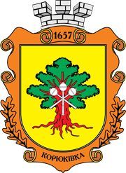
Symbols of the city

Regulations on the coat of arms of the city of Koryukivka
